![]()
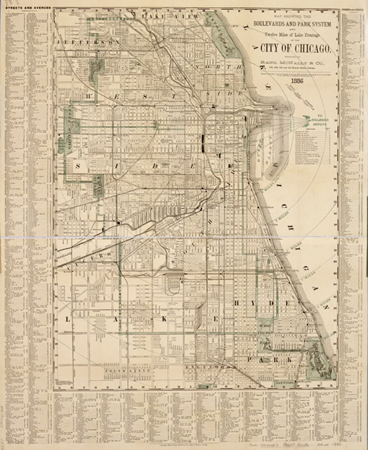
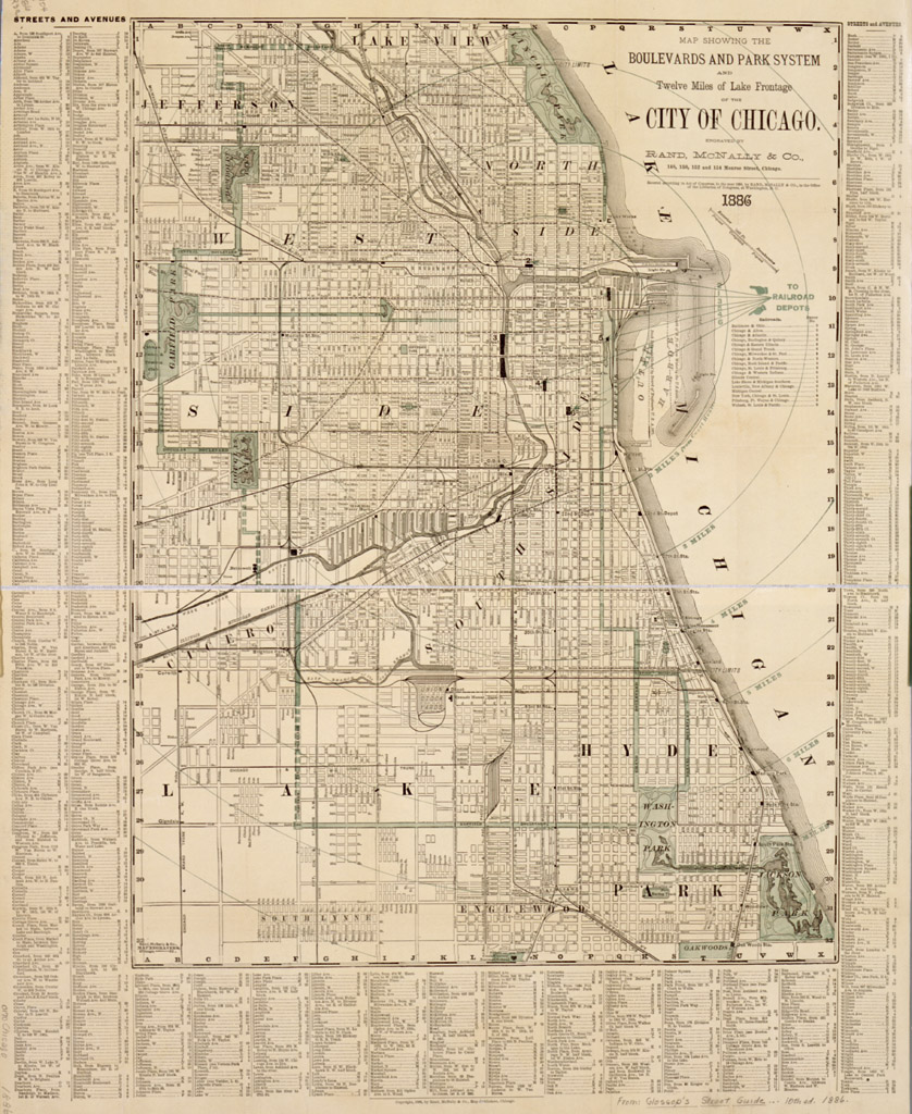
Map showing the boulevards and park system and twelve miles of lake frontage of the city of Chicago / engraved by Rand, McNally & Co.
Rand McNally and Company.
Chicago, Ill.: Rand, McNally & Company, 1886.
1 map: col.; 71 x 56 cm.
Scale indeterminable. Includes index to streets and avenues.
Detached from: Glossop, Frank. Glossop's street guide, strangers' directory and hotel manual of Chicago. 10th ed. Chicago: [Frank Glossop], 1886.
(CHS ICHi 31337)
Return to Prints & Photographs TOC | Return to the HADC Table of Contents